


Caminito del Rey is a natural pedestrian trail in the Malaga region. It was once one of the most dangerous trails to take because it is located on a vertical rock wall with a watercourse below.
Ever since I know this pedestrian route, from the photos and videos that can be found on the Internet, I wanted to do it. And I finally managed to book a ticket. It really is an excellent radical experience, done on suspended walkways in the middle of rocky walls.
Are you already interested? Want to know where it is and how to make reservations? How to get there and where to stay? Well, we will explain everything, but first a small framework of this route to know how and why it was created.
Caminito del Rey history
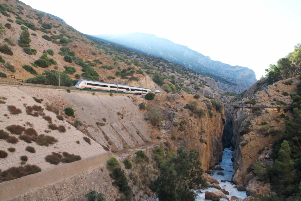
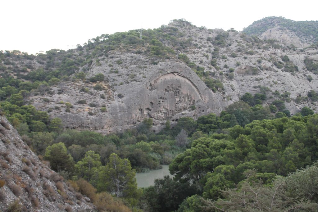
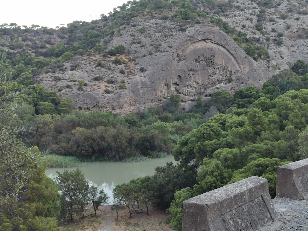
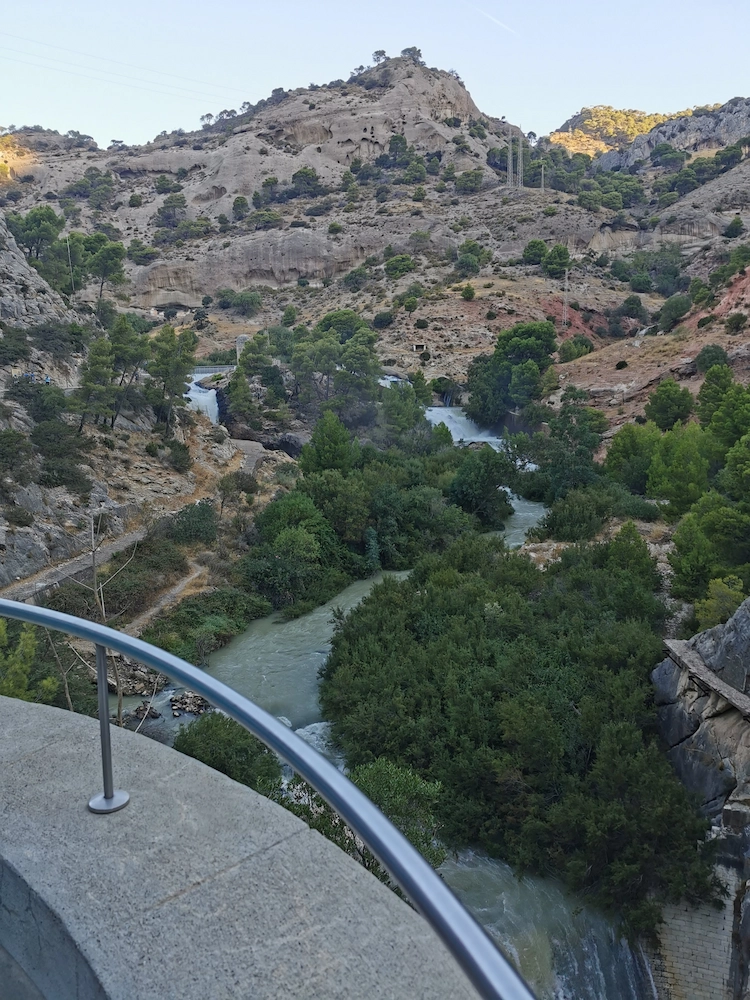
The Caminito del Rey is located in the Los Gaitanes gorge in El Chorro, where the train line from Seville to Malaga also passes. This trail was built by the former workers of the existing dams in this gorge between 1903 and 1905. It served for its construction and subsequent maintenance.

Initially, the trail was quite dangerous and risky, but at the same time, very challenging and even had the presence of King Alfonso XIII. Since then it has been known as the Caminito del Rey. Over the years, the existing structure has deteriorated and this route has become increasingly risky, as it is no longer used for its original purpose.
It was later closed and restored to be reopened to the public in 2015 with all the security required and necessary to receive its visitors.
How to arrive
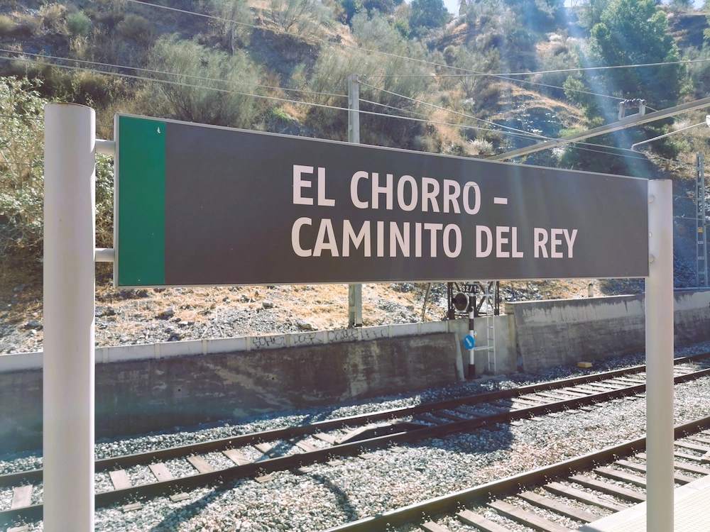
You can reach Caminito del Rey by car or by train. If you come by train, you should take the train to El Chorro station, in Alora from Seville ou from Malaga. This train station is located at the end of the route and from here you can take the buses that take you to the beginning of the route.

By car, you should follow the direction of El Chorro. El Chorro is the small village where the trail ends. To get here, coming from Seville, you must follow the A-92 that connects to Granada. After leaving the motorway, you can follow any of the directions shown on the GPS. The roads near the Caminito del Rey area are narrow mountain roads, but with breathtaking views.
The closest airports will be those of Seville or Malaga. Here you can rent a car, catch the train or by a guided tour.

Upon arrival in El Chorro, you can choose to leave your car in three locations. In the village of El Chorro and take the bus to the beginning of the trail. Leave the car in the paid parking lot at the Visitors Center, which is already close to the entrance to the beginning of the trail and where you can take the shuttle bus that takes you to the beginning.
If you visit Ronda, you can include a visit to Caminito de Rey in your itinerary, as it is only 60 km away on the A-367.
Search for your trip
How to book tickets
You can book the ticket in two ways: purchase an organized trip; or purchase the ticket individually on the official website of Caminito del Rey. Due to high demand, especially on weekends, you should buy well in advance. Usually, on the website, tickets are available 4 months in advance.
It is also possible to buy last-minute tickets at the entrance to the Caminito, but it is not recommended, as you may not be able to enter. But if this is your case, go to the beginning of the route as early as possible.
The experience
1st part of the section: reception centre and pass
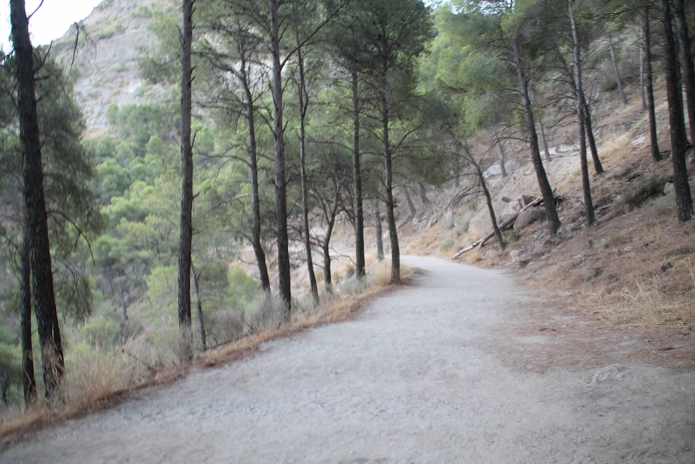
The beginning of the route is a walk along a dirt path beside the river, through a valley and pine forest. This beginning can be accessed by two accesses. The first allows you to reach the reception in 25 minutes (distance of about 1.5 km) and the second is 50 minutes (distance of 2.7 km) from the reception and validation of tickets.
We opted for the closest one and as far as the reception centre the slope is quite slight and the walk quite pleasant.
In the beginning, we have to cross a narrow tunnel of 150 meters that leads to the dirt road.
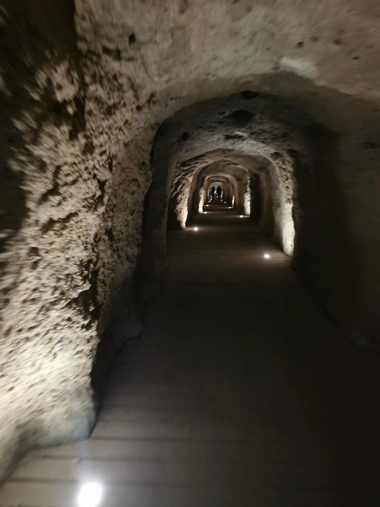
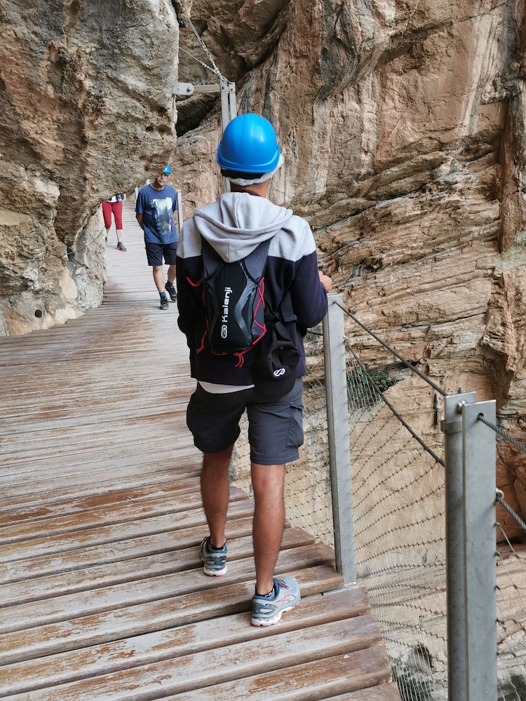
At the end of the route, we find reception, entrance control and delivery of helmets. There are also bathrooms here.
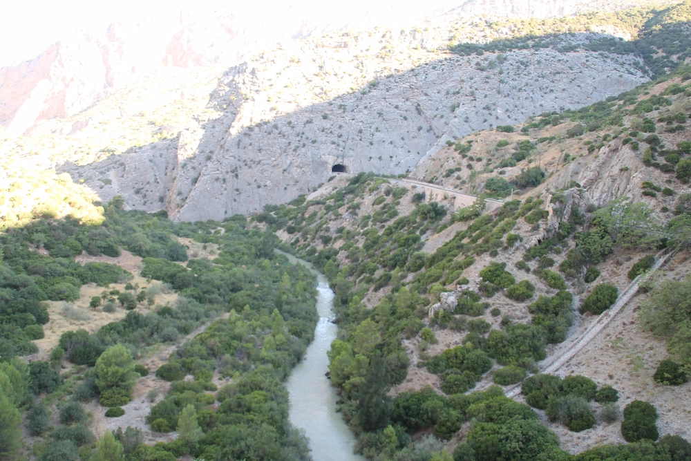
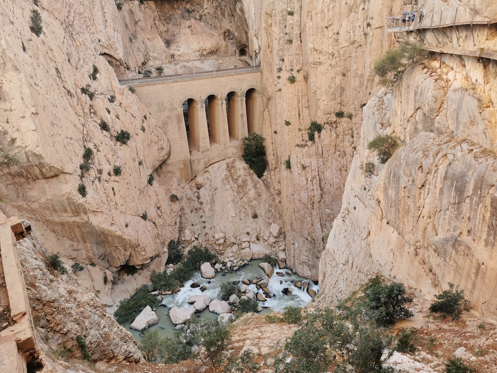
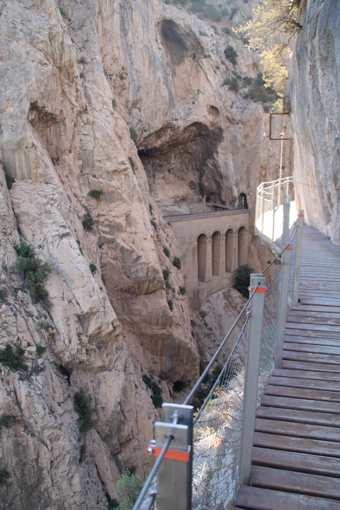
After starting the official route, we will pass by the Gaitanejo Hydroelectric Power Plant and very close to the dam (Presa de Gaitanejo). It was here that the water was diverted to artificially travel the entire gorge, until it passed to the other side, through a bridge.

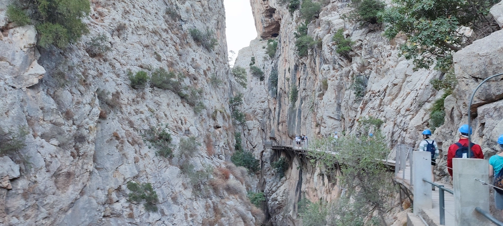
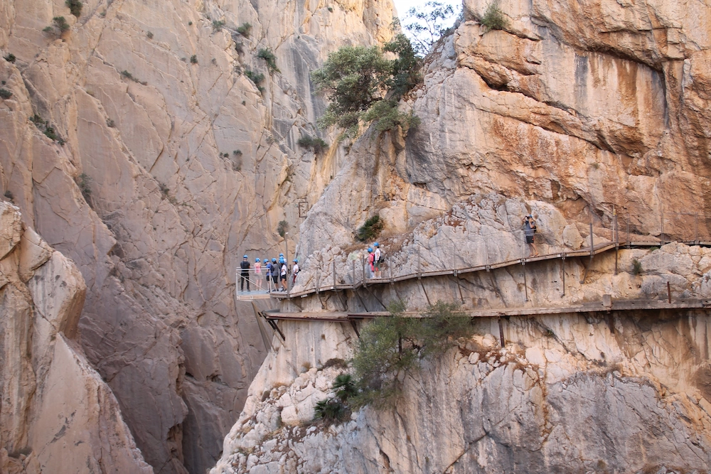
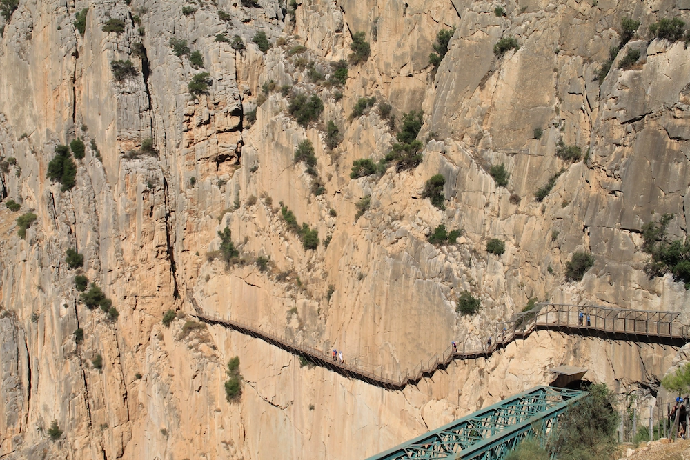
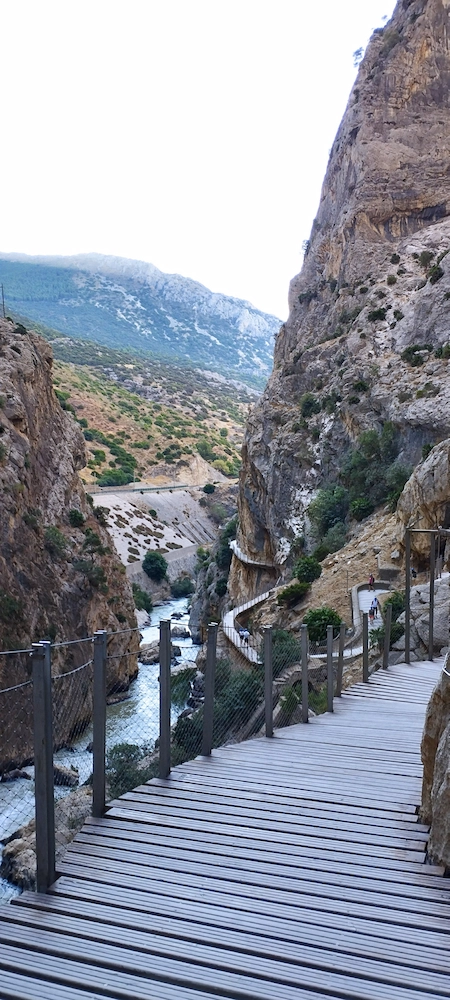
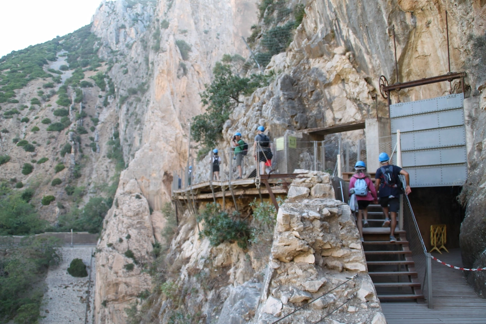
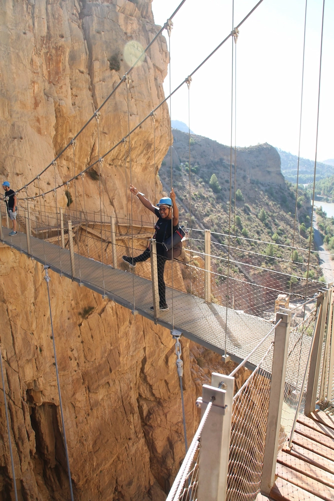
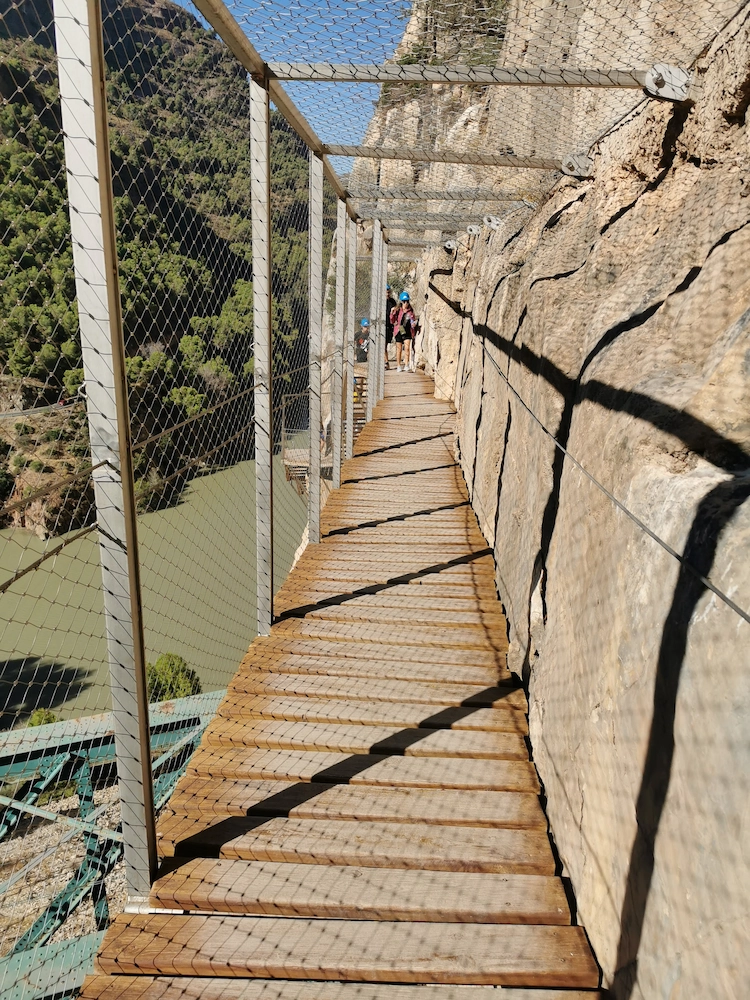
Continuing the walk, we will pass by “point zero” and enter a very narrow and high gorge. Here, the suspended route on boards also begins and this is where the strong emotions begin 🙂
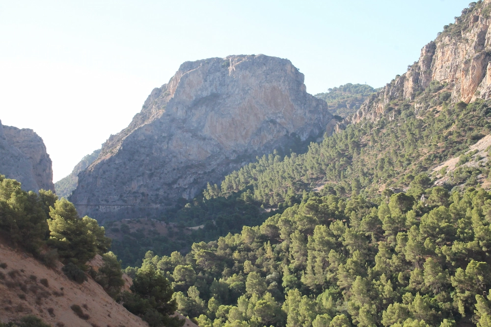
This first part of the route is approximately 1 km long. To go through it we had to go close to the water, in a narrow gorge that later becomes wider, we passed through small tunnels and saw parts of the old channel. We can also see the railway on the other side of the gorge, through the various tunnels and openings.
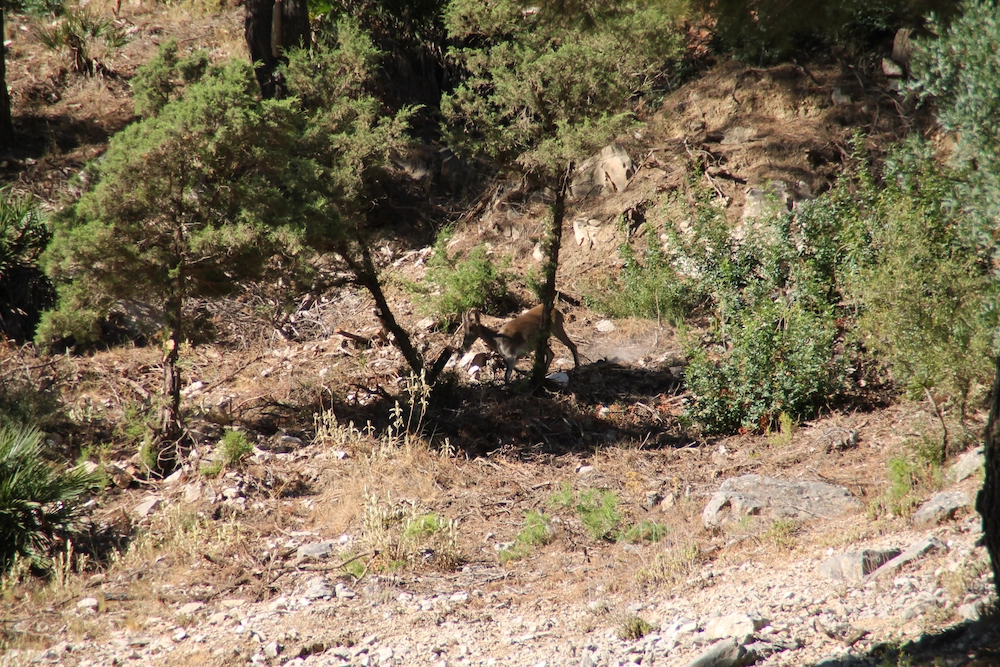
The end is quite interesting as it ends at an opening in the gorge known as the “Valle del Hoyo” where the river is calmer and the route is again on dirt, through pine trees and where you can observe wild animals.
2nd part of the section: Los Gaitanes gorge and south wall
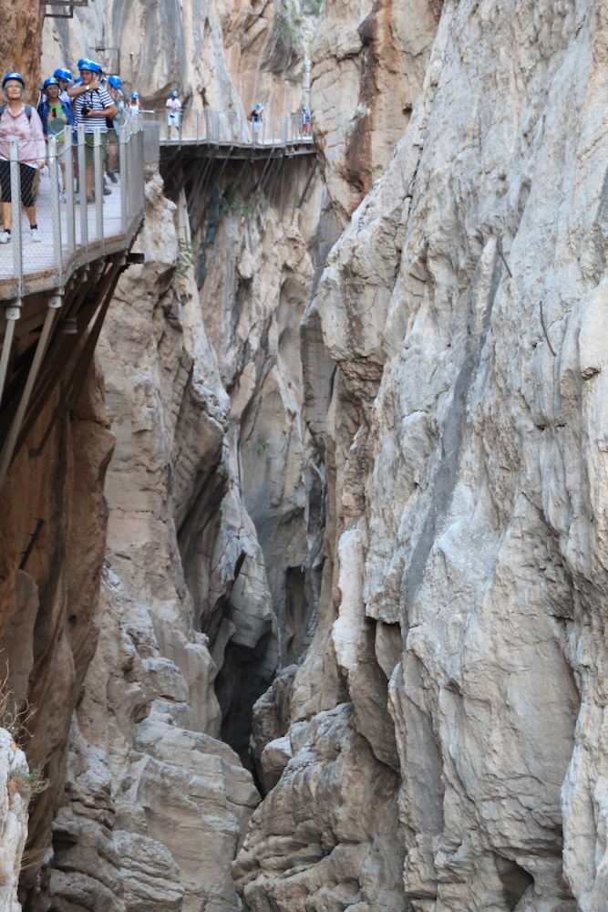
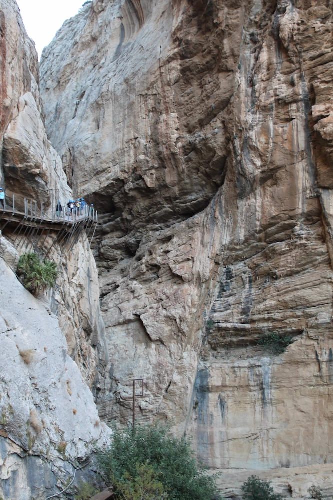
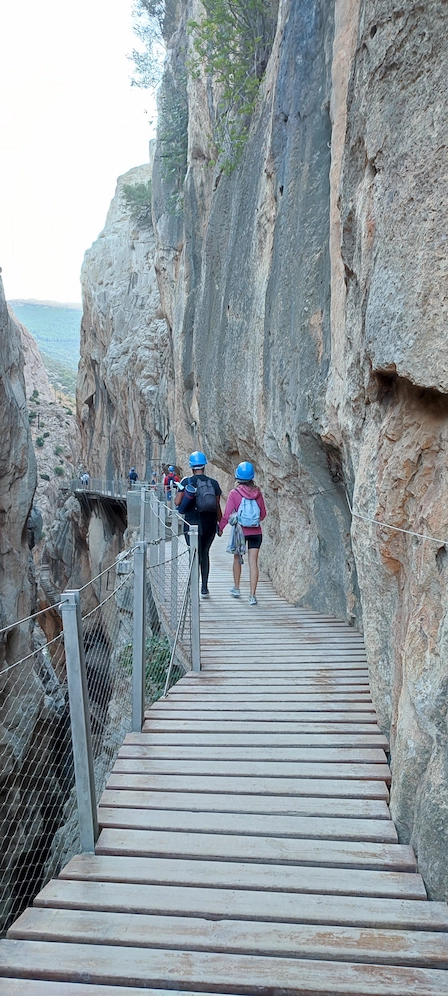
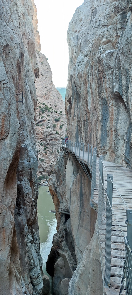
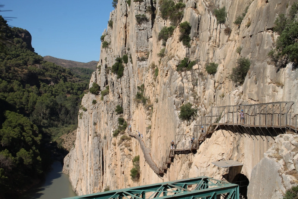
After completing the widest part of the section, you enter the gorge again. This is the most interesting area and where those with the most vertigo will have to fight against them to complete the route.
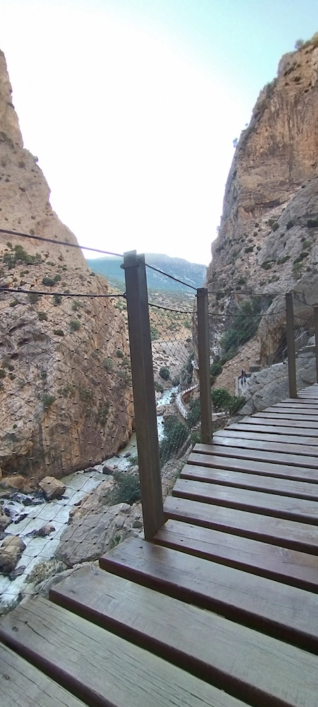
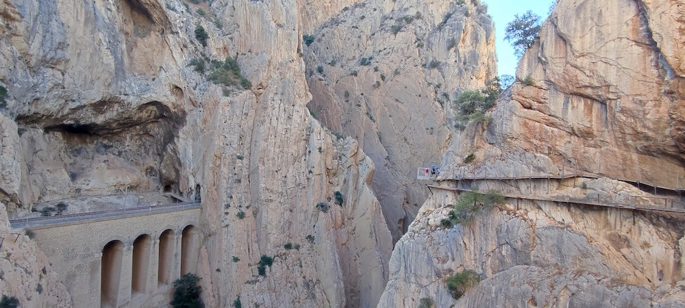
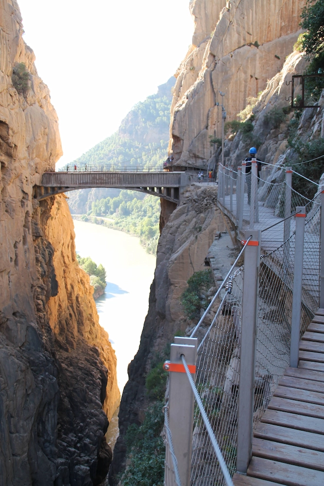
The entrance to the gorge starts at 2390 meters and is next to the channel’s lock. Here the canal began its journey underground until emerging at the aqueduct bridge. This part of the inland route is currently used on rainy days and when safety is in question.
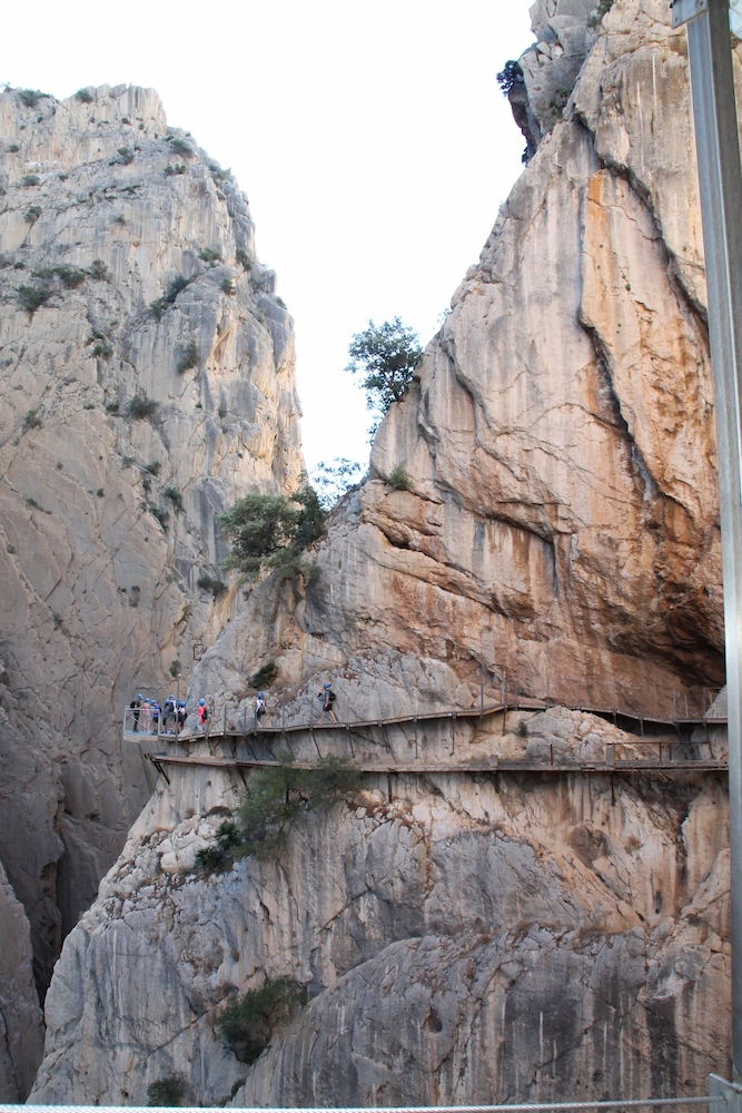
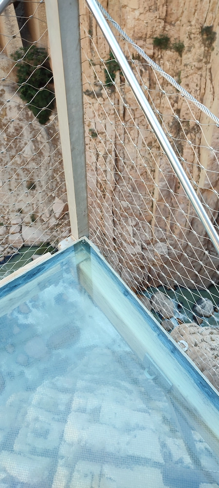
This part of the route is quite high, both above our head and the distance to the river. Along the way, there is a glass counter, an ideal place for taking pictures.
Parts of the route are on the old route, which allows us to observe its state of degradation. The most stunning thing about this part is its height.
In its final part, after 2900 meters we find the aqueduct bridge and a metallic bridge over which we will have to cross, at 105 meters high, to the other wall. The bridge is 35 meters long and doesn’t expect it to “dance” with every step you take and the feeling of emptiness is enormous.
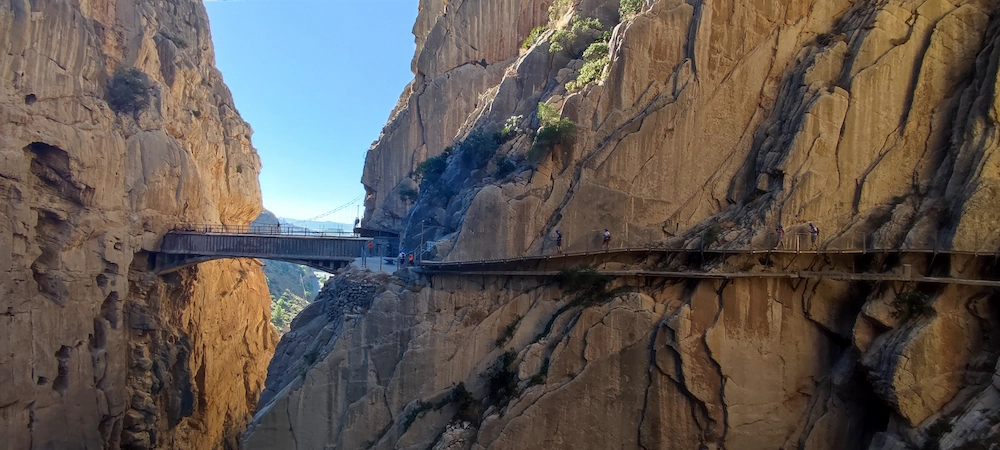
On the other hand, the route takes place along the vertical wall, which is the area that caused us the greatest “chills” on the stairs, along the route, so that it passes over the tunnel of the train line. It’s a grand finale.
Then it’s up to the rest of the route until the helmets are delivered. In this part of the route, we find some buildings from the old village of “El Chorro”.

Recommendations
The Caminito del Rey is a pedestrian route in which a large part is carried out on a wooden walkway inside a gorge. The biggest recommendation is not to do it if you suffer from a lot of vertigo.
Moreover, the route is well marked, and well maintained and along the way we find several employees prepared to support us. Due to its size take food and water.
- The route is not linear and you can purchase a ticket for the buses that take you from arrival to departure with your ticket.
- Arrive on time. Do not forget that you will have to walk part of the way to the entrance of the route. Count at least 30 minutes in advance.
- Children under 8 years old cannot take the route.
- You cannot take hiking poles.
- Try to go to the Caminito between spring and autumn. In summer, the region is quite hot and in winter, the probability that the route will be closed due to weather conditions increases.


Plan your trip using the following tools or website
Using the following links and tools on the website you are helping to maintain Scannertrip. This use is the same for you and you do not pay more for it. For Scannertrip it makes all the difference!!
Hotels
To find the best hotel stays use Booking. It is one of the best websites for booking stays, always with promotions on some destinations. The reliability and ease of booking and cancelling make it even the most popular.
Flights
Compare Hotels prices
To compare prices for your Stays you can use the Hotels Combined or hotellook websites. These search engines show different prices from other websites for the same destination. There may be a lower price for the same hotel on another website and these search engines will show it.
Rent a car
If you choose to rent a car, also use the price comparators. The autoeurope website compares prices from different rental companies.
Activities
When preparing what to do at your destination, you will search for activities to be occupied. Use this activity comparator in the scannertrip provided by the Musement, tiqets or the civitatis.
Transfers
Transfers to and from the airport can be purchased via the website kiwitaxi. So you don’t need to get in touch with the different companies in your destination looking for the best price.
Bus or Train
If you need to travel by Bus or Train to your destination you can use this tool to help you to find the best rates.
Suggestions for your stay near Caminito
The Caminito is located in a mountainous area, far from large cities. For this reason, accommodations are essentially based on local accommodations.
Booking.comOr choose from the most popular options in the area.
Enjoyed getting to know the Caminito! Are you willing to visit it? You will certainly find reasons in this small guide. Enjoy and also know the surroundings. If you are curious, you can read other articles about Andalusia.